[11.1] - Back to the park
The following is a map showing contour lines for a region of Orangerock National Park.
Estimate (numerically) the average elevation by sampling the elevation at the mid-point of each sub-rectangle.
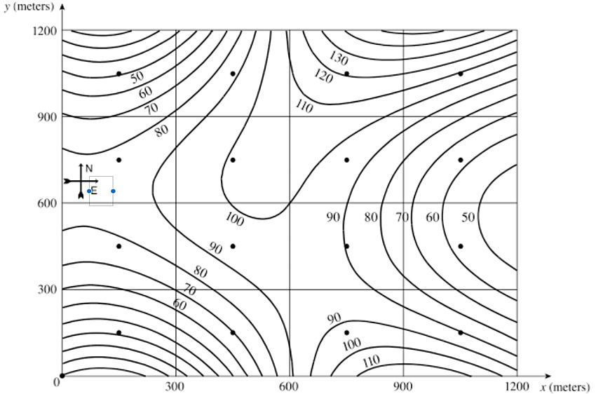
The following is a map showing contour lines for a region of Orangerock National Park.
Estimate (numerically) the average elevation by sampling the elevation at the mid-point of each sub-rectangle.